INDESO
Infrastructure Development of Space Oceanography (INDESO)
Within the project INDESO, the Indonesian government is developing its infrastructure for operational oceanography that includes an operational model of spatial tuna dynamics (skipjack, yellowfin and bigeye) for the monitoring and management of tuna fisheries in Indonesia.
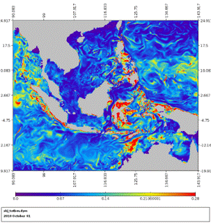
A regional high resolution (1/12° x day) SEAPODYM model is coupled off-line to a physical circulation model and use integrated primary production derived from satellite ocean color data. Open boundaries Conditions are provided weekly by a global operational model. Fisheries are included in the model and described with gear selectivity and catchability. The regional model outputs will be used to rapidly improve the knowledge on tuna species in the region and to assist Indonesian Fishing authorities in monitoring and managing tuna fisheries.

First results of the regional high resolution model for skipjack
REFERENCES
Reference:
Lehodey P., Senina I., Wibawa T. A., Titaud O., Calmettes B., Tranchant B., and P. Gaspar (2017). Operational modeling of bigeye tuna (Thunnus obesus) in the Indian Ocean and the Indonesian region. Marine Pollution. Special issue of INDESO project. https://doi.org/10.1016/j.marpolbul.2017.08.020
